USGS Historic Map Collection
October 6, 2026
The United States Geological Survey was founded in 1879 to classify public lands and examine the geological structure, mineral resources, and products of the national domain. These maps are still being developed and updated as additional information using modern technology becomes available. Both contemporary and historic maps are available online. These maps track the development of the built environment as well, including roads, rails, and cities.
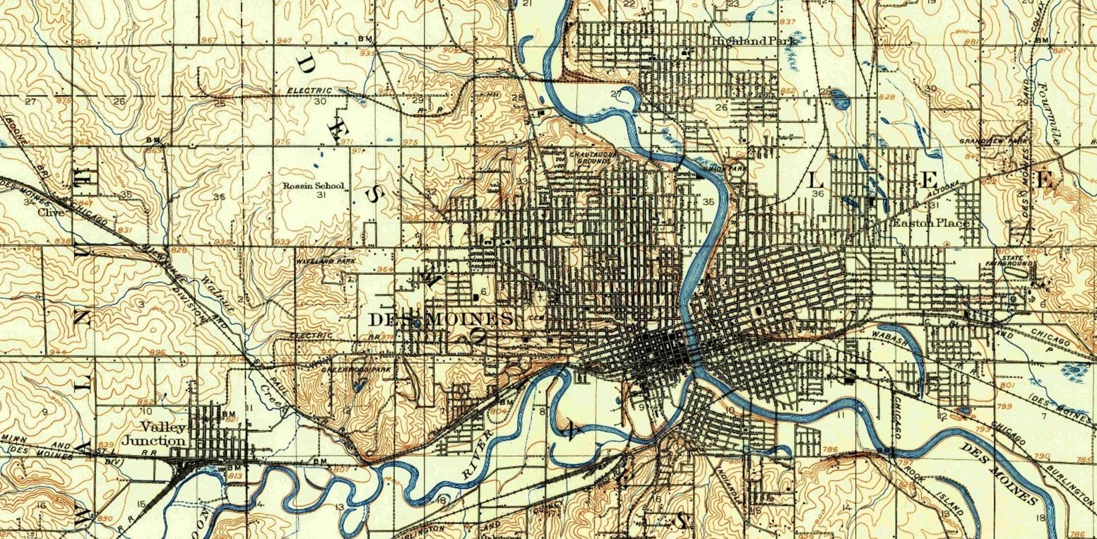
Pictured: Des Moines, Iowa 1905. Many of the major Des Moines streets (especially in Des Moines northwest of downtown) were developed along the old square-mile township section lines.
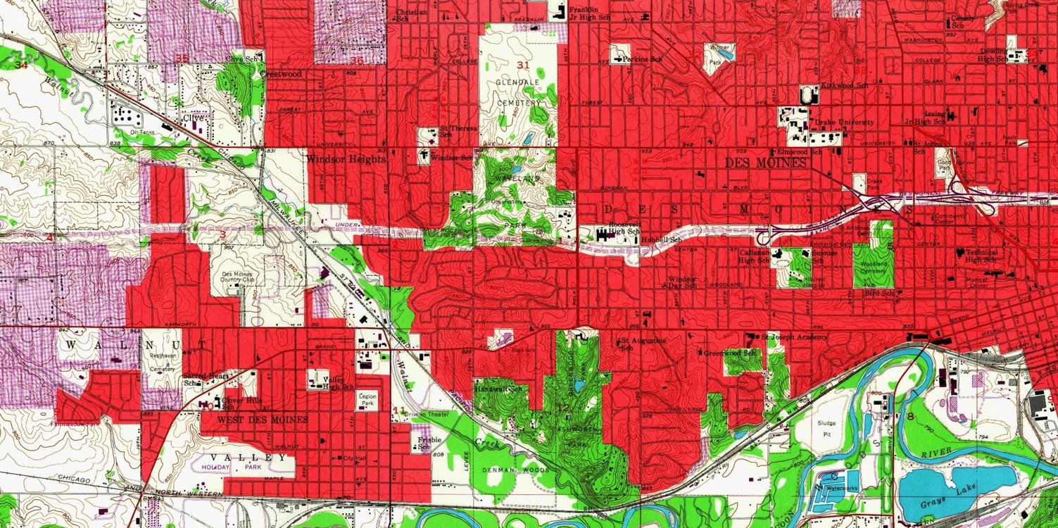
Pictured: Des Moines, Iowa 1956. Construction of I-235 (in progress) is shown significantly impacting existing neighborhoods (built up areas shown as solid red).
This Historic Map collection can be found at:
Mapping Iowa’s Transportation History
September 29, 2026
Do you still keep an Iowa map in your car’s glove box? The Iowa DOT has posted a collection of their official State of Iowa Transportation Maps dating back over 100 years.
These resources help document how the state transitioned from railway routes, to a series of town-promoted gravel roads, to our modern Interstate System.
In 1915, Iowa led the nation in number of vehicles per capita (with over 147,000 vehicles, or one car for every 15 people). Iowa currently is #5 in the nation, with 1.2 vehicles per person!
This Historic Map collection can be found at:
https://iowadot.gov/travel-tools/maps/historical-maps
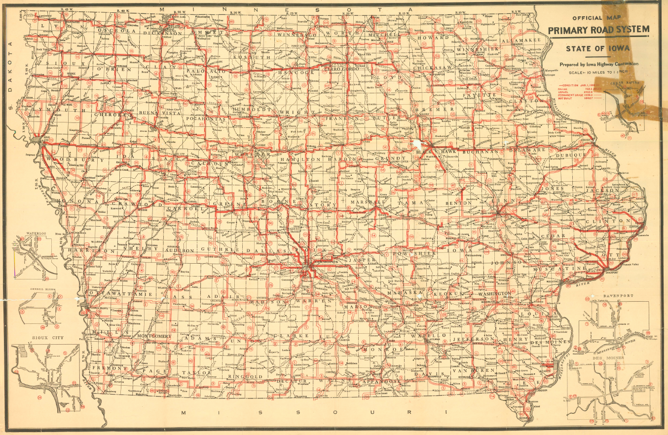
Pictured is the front of the 1926 Iowa Highway Commission Map


Historic Building Technology Library
September 22, 2026
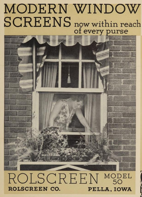
Researching historic buildings sometimes involves a deeper dive into materials and techniques available and common at the time of construction. Scans of historic building product catalogs are available on the Internet Archive. These catalogs may illustrate components used in your historic building. These source can help in determining how the building details were assembled and inspire modern options for repair or replacement.
Locate the Internet Archive for Building Technology Heritage Library (Association for Preservation Technology International) at:
https://archive.org/details/buildingtechnologyheritagelibrary
Automotive clues in dating historic photographs
September 16, 2026
Getting a correct date on a historic photograph can help establish what the building looked like during the Period of Significance. This can affect how changes that may have acquired significance are interpreted by architectural historians and the State Historic Preservation Office (SHPO) as part of your historic tax credit application review.
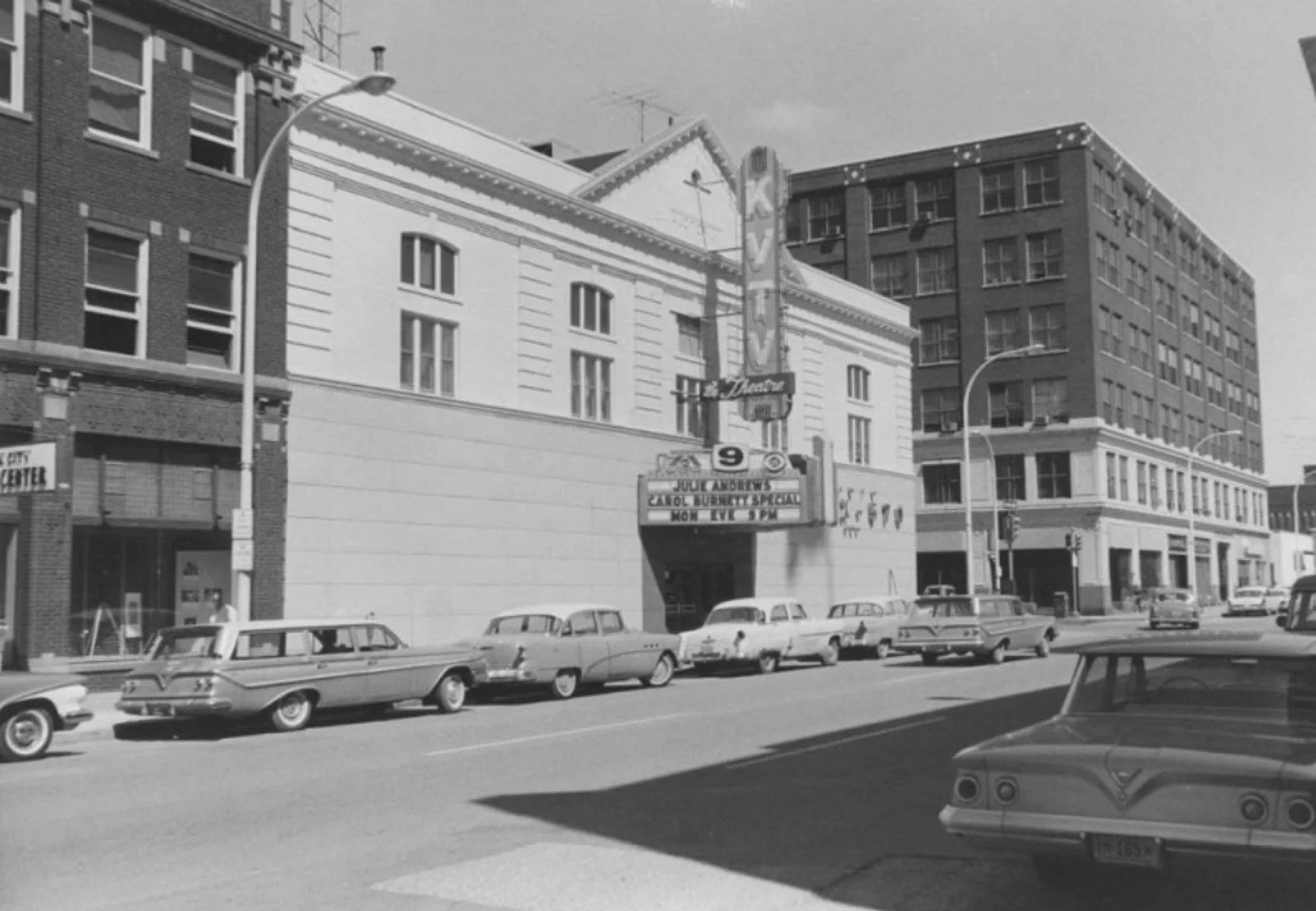
If your exterior photograph has a few cars in it, you may be able to use design changes to help establish what model year the car was, and thereby establish a time frame for the image.
License plates on the cars may be another clue. For some states, the plate changed every year with different colors or design. Contrasting colors may be identified even on black and white photographs.
Three examples of the 1961 Chevrolet Bel Air are shown in this photograph (with the distinctive dual tail lights and V shape on the trunk). However, the license plates are Iowa 1962 (black lettering on white background).
This photo was further dated by the marquee for KVTV television (Sioux City) advertising the Julie Andrews and Carol Burnett Special (at Carnegie Hall) on Monday evening (which aired on CBS Monday June 11, 1962). The KVTV building is non-extant (which is a historian’s way of saying that it no longer exists).
Locate the history of Iowa license plate designs at: https://en.wikipedia.org/wiki/Vehicle_registration_plates_of_Iowa

The Strategic Value of Archival HABS/HAER Records
September 8, 2026
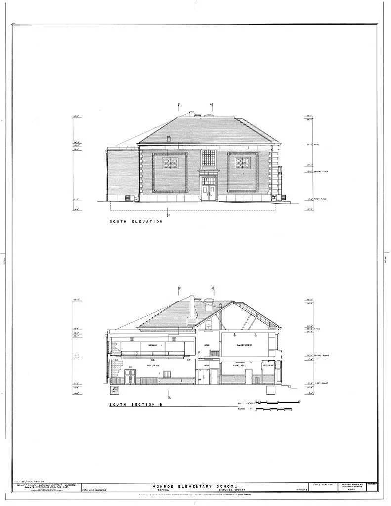
Meticulously compiled over decades, HABS/HAER (Historic American Buildings Survey and Historic American Engineering Record) documents serve as a foundation for adaptive reuse, rehabilitation, and historic tax credit applications. Accessing these measured hand drawings, large-format photographs, and written historic data provides distinct advantages during the early project phases:
Mitigating Risk: Historic measured drawings can uncover architectural details and prior modifications, preventing costly design revisions and construction delays.
Streamlining Approvals: State Historic Preservation Offices (SHPO) and the National Park Service (NPS) rely on historic documentation during project review. Referencing official HABS/HAER materials strengthens Part 1 and Part 2 of the Historic Preservation Certification applications by clearly establishing the character-defining features.
Establishing Accuracy: Historic records offer an valuable reference for original craftsmanship, guiding restoration choices and structural solutions when existing conditions have been obscured by subsequent alterations.
Whether converting an early 20th-century industrial facility or restoring a landmark civic structure, consulting the HABS/HAER archives in the pre-design phase mitigates design guesswork. This historic baseline bridges the gap between heritage stewardship and modern building codes, guiding contemporary rehabilitations that honor the original structure while modernizing functional performance.
By integrating HABS/HAER resources into early project execution, designer teams, developers, and site custodians safeguard both architectural heritage and project feasibility.
Locate the digitized Library of Congress (LOC) Historic American Buildings Survey (HABS) Collection: https://www.loc.gov/pictures/collection/hh/
Example shown: Monroe Elementary School, Topeka Kansas..
Sanborn Maps: The Cartographic Key to Architectural Provenance
September 1, 2026
For architectural historians and historic property owners, establishing an accurate timeline is the foundation of any serious preservation effort. Among the most vital primary resources available for this research are the historic Sanborn Fire Insurance Maps. Originally produced between 1867 and the late 20th century by the Sanborn Map Company, these large-scale, color-coded cartographic documents were designed to assess fire risks for urban commercial and residential structures. Today, they serve as extraordinary, frame-by-frame diagnostic tools for deciphering a neighborhood or building’s evolutionary history.
Sanborn maps allow researchers to trace physical transformations across distinct time intervals. Through a standardized system of visual shorthand, each map record provides precise documentation regarding:
Footprint and Massing: Outlining the exact structural boundaries, porch configurations, outbuildings, and subsequent footprint additions or demolitions over time.
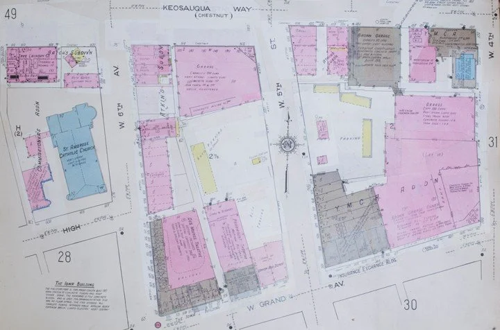
Materiality and Construction Class: Utilizing specific color palettes to denote primary structural materials—pink or red for brick, yellow for frame construction, blue for stone or concrete block, and brown for adobe.
Fire Separation and Openings: Indicating parapet wall heights, party wall configurations, window openings, and skylights, which inform original daylighting strategies and structural vulnerabilities.
Historic Land Use: Documenting historic occupancy and functional zoning, from light industrial uses to residential floor plan divisions.
By comparing sequential editions of Sanborn maps (typically updated every decade or by pasted-in revision slips) preservationists can isolate exact timeframe of building modifications. Identifying when a rear wing was added, when a timber carriage house was replaced by a brick garage, or when a commercial storefront was reconfigured allows property owners to differentiate between original historic fabric and later accretions.
Ultimately, Sanborn maps bridge the gap between archival history and physical fabric. They provide property owners and preservation architects with the objective, empirical evidence needed to substantiate Historic Tax Credit applications, draft Historic Structure Reports (HSR), and execute accurate, period-appropriate restoration strategies.
Locate the digitized Sanborn Maps for your property at the Library of Congress:
https://www.loc.gov/collections/sanborn-maps/?searchType=advanced
Example of downtown Des Moines Iowa map from 1932 shown.